

 Reply With Quote
Not a place I'd heard of before!
Great piccies, though.

 ForumSage
Thought I might post a bit about a trip we did to the old Uranium Mining town on Friday, Its not a 4WD destination as such but if you going between Mt Isa & Cloncurry and you have a sense of history you'd be nuts to go past it.
I bumped into 'TroppoJon' (another member) at Supercheap in Mt Isa and he sugested I grab the book Cloncurry Trails, which is full of mud maps, a big help
I was also chatting with 'Tank' here on AULRO, he used to live and work there.
It was an errie feeling walking thru the town, not sure if I was looking into the past or future
below is virtually a cut & paste from out blog at Going Bush
written by my wife, Val
(the old pics were found on the google images, Frank might have some I can add)
-----------------------------------------
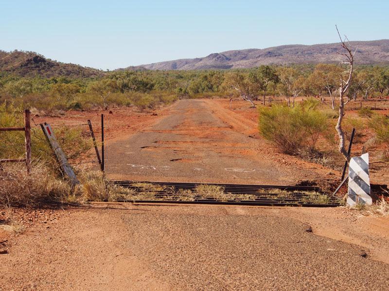
An early start today as we headed East along the Barkly Highway towards Cloncurry about 58kms
enroute to the Mary Kathleen Uranium Mine (now abandoned). The scenery along the way was great, I believe
it is still part of the Waggaboonyah Range. We turned North onto the road leading into the site of the
original township of Mary Kathleen.
This road, once sealed, is now in a very bad state of disrepair, with
large holes in the bitumen where it has broken or been washed away. The site of the township is only
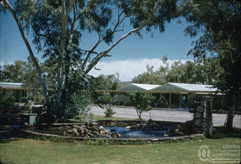
about 2km off the main Highway with a stone entranceway that must have looked quite grand when the
township existed. Just inside this entranceway is a large circular garden bed about 3ft high, no longer
welcoming and full of colour but over-grown and tangled with weeds.
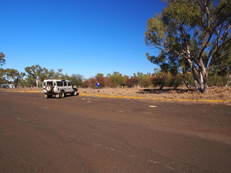
We had an aerial map of the original township and also a mud map with which to identify where the various
buildings originally stood. We drove through the entrance and turned left towards the site where the Police
Station was once housed. The roads were sealed and as yet, not overgrown with weeds so it was rather an
eerie feeling to drive along the streets of a once thriving town with only the concrete bases to give testament
to the once proud buildings that had stood on them.
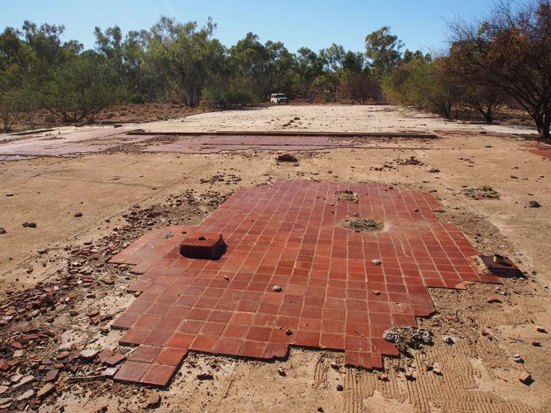
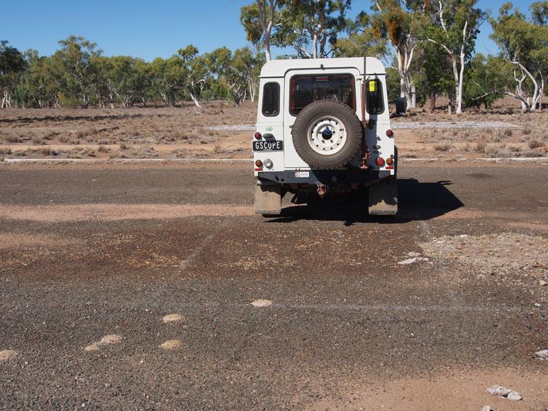
We pulled into the kerb in front of where the large Cafeteria used to be (parking correctly, habits are entrenched)
then got out to explore. We walked around, what would have been a lovely shaded square, and across the foundations
of the General Store, General Shops, Recreation Room, Library, Hotel, ANZ Bank, Town Office, Post Office, Medical Centre,
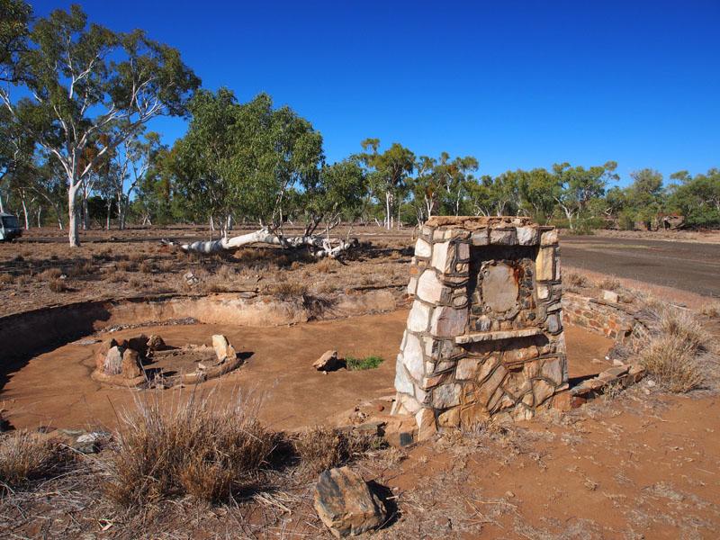
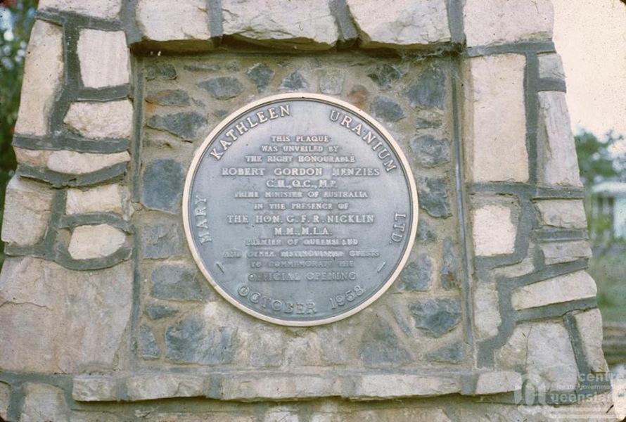
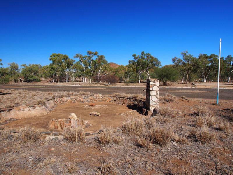
Town Hall and Pottery Club. At the corner of the Square was a large stone obelisk, its centre piece removed; just a circular
scar remained where the plaque denoting the opening of the town of Mary Kathleen in 1958 by Sir Robert Menzies (then Prime
Minister) had once taken pride of place. This stood in front of what would have been a pond with two stone garden surrounds
within. I'm sure this would have looked extremely attractive when the town was here.
NOW
THEN
NOW
THEN
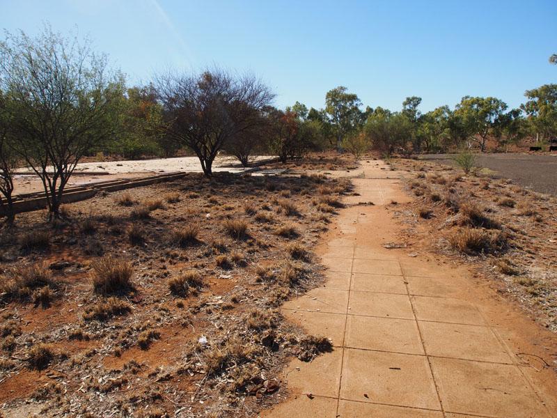
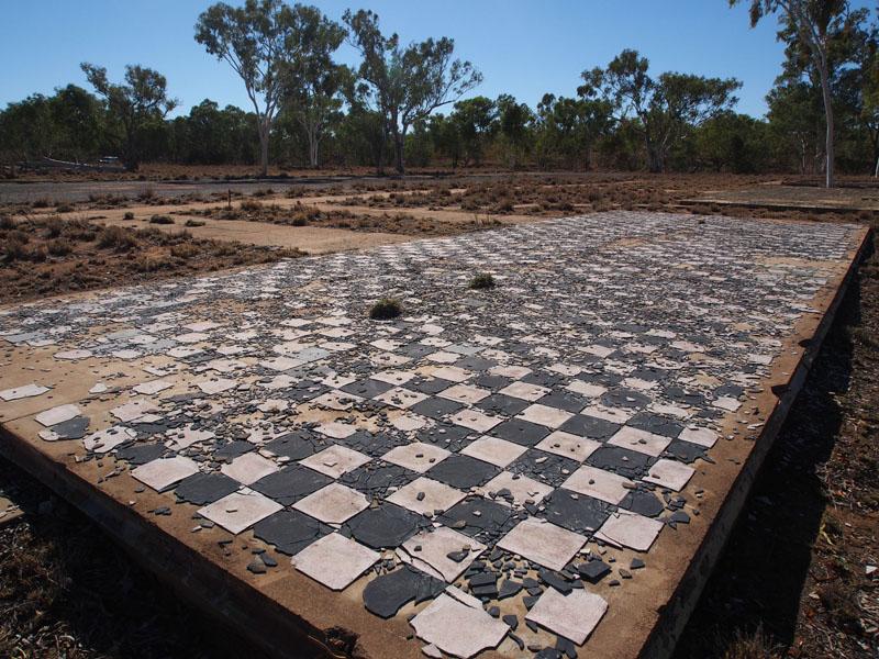
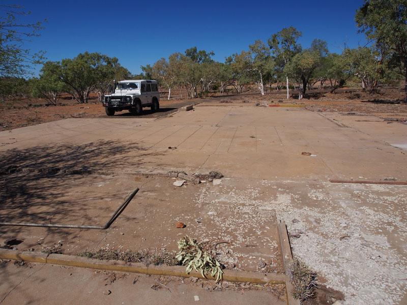
We next walked across to where the Fire Station was housed then up through the residential area to the Police Station. It
was quite a strange feeling, walking across the foundations where other people had once called home; where they had done
their shopping, chatted with each other in the street and bustled around the various shops. Children would have laughed and
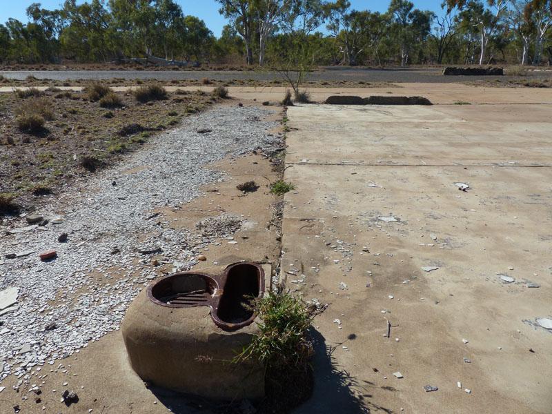
played as they rode their bikes around the Square. Now all that remained were some concrete foundations, broken floor tiles
and a few pathways with the odd plumbing evidence to remind you of the infrastructure that would have been needed for a town
of this size and population. As I stood there in reverie, I recalled when I came home on leave from the Army and visited the site
of the old house I had grown up in. I stood on the gravel road and just stared at the now empty acres in front of me; piles of dirt
heaped up where the old house used to stand. The trees I used to climb, still standing but looking small and insignificant without
all the surroundings that had made this my home. I cried as I gazed at my childhood of past, now obliterated by progress. Would
these children that once played here, in Mary Kathleen, feel the same if they revisited this site?
ANZ BANK
PMG OJ (spent most of my life working on these)
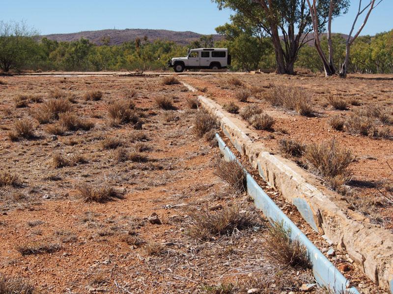
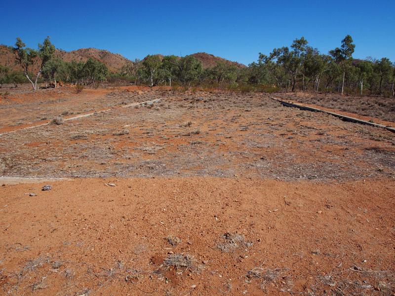
We ambled back to the car and continued the drive clockwise, across the Corella River (dry) around past another residential area,
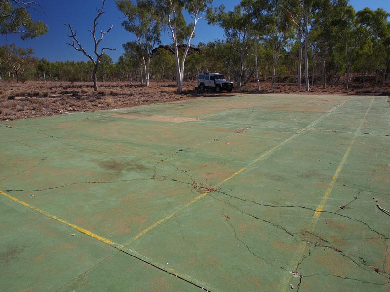
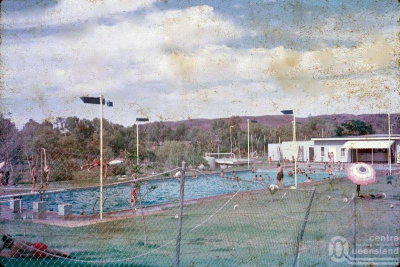
Apex Hall, BMX Track and up to the site of the Cinema and Lawn Bowling Club. Next we located the sites of the Swimming Pool,
School, Tennis Courts, Basketball area and the Sports Oval. These latter being on the South side of the Corella River. Crossing the
River again and past the residential area on the North side, we arrived back at the entrance to the town. This had been an extremely
thought provoking journey through this now abandoned township. Life moves on.
Pool Change rooms
Pool edge
Pool Now
Pool in its day
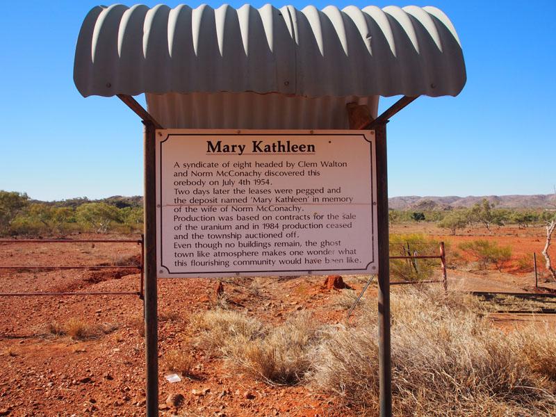
Some brief facts….the Uranium deposit was discovered by Clem Walton and Norm McConarchy in 1954. Mary Kathleen was named
after McConarchy's wife. The town enjoyed prosperity between 1956 and 1963 until it was placed in mothballs. It was re-opened in
1974 until 1983 when it was closed due to the Federal Government's three mine policy. Mary Kathleen was closed and the entire town
including houses, went to public auction in 1983. It is now privately owned and access allowed by the generosity of the owners. In 1961
the population was around 1,000 and by 1981 there were over 2,000 residents.
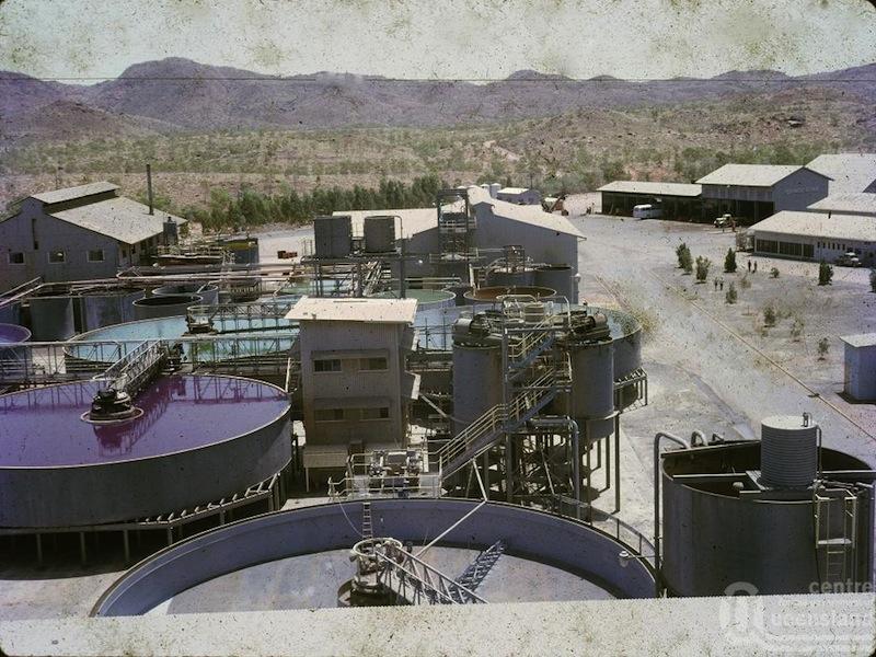
Old processing plant area
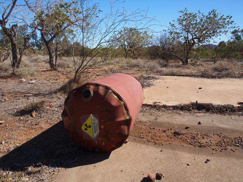
Drum looks about to burst
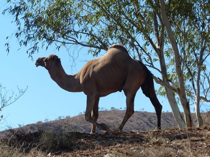
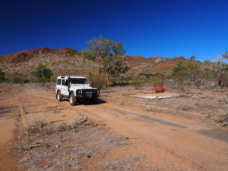
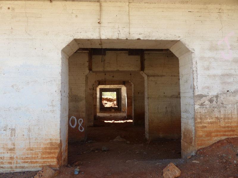
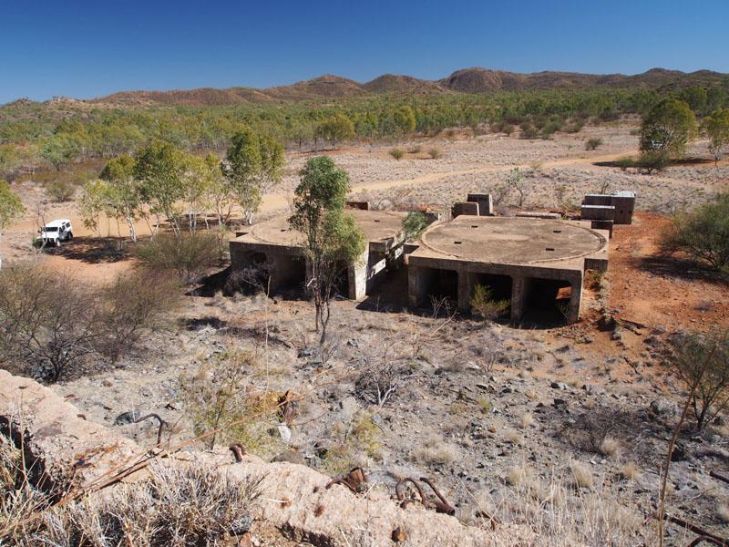
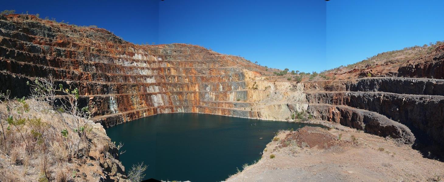
We left the town area and took a dirt track North for about 6kms where we came across the concrete remnants of the mining operations.
We pottered about here for a short while then took another dirt track up to where we could gain access to view the Mine Pit. As we crossed
over a dry creek bed we spotted a number of wild camels just above us. They looked very fat and healthy. We arrived at the track that went
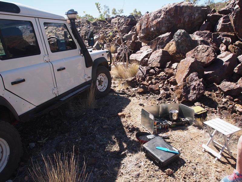
up to the Mine Pit but before hiking up this track, we went up on top of a nearby hill and enjoyed the view whilst we boiled the billy and enjoyed
a toasted sandwich that Don cooked on his little cooker just beautifully.
Crushing plant
crusher
back when
Back down the hill, we parked at the fence, wriggled around the side of it and began the long trek to the Open Cut. The walk to the Mine Pit
was about 1.5kms (3km round trip), which wasn't difficult. Once at the top, there were a few rock barriers to climb over to get a good view. It is
not the biggest Open Cut we have seen but it was definitely interesting and significant because it is a Uranium Mine. Back down the hill again,
around the fence and back in the Landy, we headed back to the highway and West to Mt. Isa.
Not a place I'd heard of before!
Great piccies, though.
Killer Wabbit!
Did you visit the Mary K museum in the Curry, quite interesting. We stopped in at Mary K a few years back after the a big wet, weird but & the wife just wanted to go home so we didn't stay long.
Jonesfam
Master
Landy.. V8, petrol or gas? Not any more its Nuclear! looks awesome, sounds interesting. Was it safe? I saw the radiation symbols on stuff there, it's not like that just disappears in a few years??
Swaggie
don't defenders look great out in the bush....you look at the defender as well as the scenery.....if it was an LC200 you would look straight past it.....
TopicToaster
Those pics bring back a few memories. I used to live in the Isa back then and was at the clearance sale where the houses and all were auctioned. There were trucking companies there waiting to move the houses.
Cheers......Brian
1985 110 V8 County
1998 110 Perentie GS Cargo 6X6 ARN 202516 (Brutus)
Wizard
Thanks very much for those pictures - brought back memories from when I visited about 15 years ago
Did that (near bursting!) drum actually have anything in it?
Super Moderator & CA manager
SubscriberWow, never heard of that place before. Reminds me of Yallourn down in the Latrobe Valley. It was built by the SEC for the workers of the Yallourn open cut and Power Station. It was a beautiful town, but torn down in the 70's to get to the coal deposits underneath. where it was is just a hole ithe ground now. My parents moved one of the houses way back when to Boolarra where I grew up. I remember as a kid going to the Yallourn cinema and going to the pool there. They were about the last surviving part of the town.
Looks like it wasn't the only town to disappear due to the ebb and flow of mining.
Thanks heaps for posting this.")
If you need to contact me please email homestarrunnerau@gmail.com - thanks - Gav.
YarnMaster
Thanks for posting, what a interesting place. One day it's full of people , then gone forever.
Swaggie
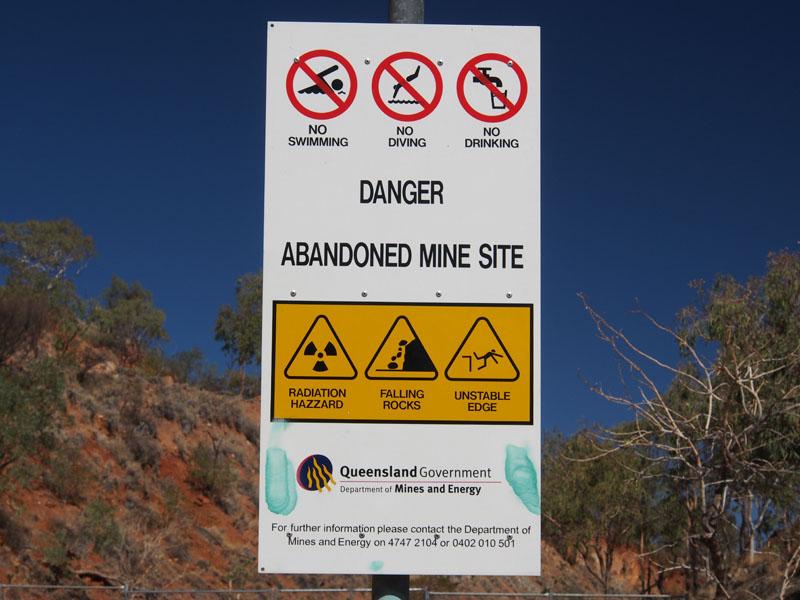
Wifes family (and her as a little one who went to school there) lived/ worked there in the 70's. We went back a while ago and had a look, dead cow on one of the old housing slabs, and that blue colour of the old pit was amazing. I liked the no swimming signs complete with radiation warnings
SWMBOs father helped construct the gun club back then, and we went on a trip out to the wee Mcgregor mine where we saw graffiti on the walls of a tunnel that we could just squeeze the rangie and CT through where names of some of his friends and work mates had been drawn from wayyy back then!
http://www.bonzle.com/c/a?a=col&fn=j...=0&mo=39739271
http://www.bonzle.com/c/a?a=p&p=264954&cmd=sp
We continued on and camped at fountain springs, a very quiet and peaceful campsite.
https://www.google.com.au/search?q=f...ml%3B282%3B500
JC
The Isuzu 110. Solid and as dependable as a rock, coming soon with auto box😊
The Range Rover L322 4.4.TTDV8 ....probably won't bother with the remap..😈
 Posting Permissions
| Search AULRO.com ONLY! |
Search All the Web! |
|---|
|
AULRO.com Copyright 2001 - 2025 Independently Owned and Operated by Dave Blears Computing - DavecandoIT - AULRO.com LAND ROVER and its logo are the registered trademarks of Land Rover. Land Rover is not affiliated with AULRO.com. |
|

Bookmarks