

 Reply With Quote
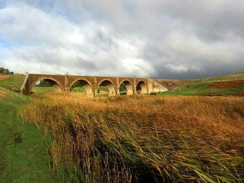
Ok I'll be out for much of the day but I'll leave you with this abandoned broad gauge railway bridge, once again north of Adelaide.


 Master
Mr utey got in first with Forrest. Well done.Originally Posted by bee utey

Your turn.")
AT REST
Ok I'll be out for much of the day but I'll leave you with this abandoned broad gauge railway bridge, once again north of Adelaide.
YarnMaster
Hi,
We passed there after camping at Red Banks, out of Burra on the way to Morgan.
It is about 100m to the right of the Burra-Morgan Rd.
Nice masonary with no rail lines.
Cheers
Wizard
SubscriberI have landed there for fuel. Very good runway. I think QANTAS still use it for training. All that was there was the refuelled and his wife and roo shooter. We nearly broke down there. Didn't like our chances of getting a cold beer.
[SIGPIC]
2012 LR Defender 90 (BERT) Gone
2012 Husqvarna WR 300
2014 FPV F6 Gone
2005 D3 SE V8
2011 D4 V8
2016 Moto Guzzi California Audace.
Master
There is usually a good chance of a cold beer at Forrest. It just depends who is looking after it. The caretakers head out there for +- 12 month shifts. I have done a bit of work based out of Forrest and have always been well looked after. The runway is maintained to its high standard as it is the only alternative to Perth International if there is weather preventing flights landing at Perth. For that reason Qantas and other airlines make sure their flight crew are all familiar with it. There's always avgas or Jet A1 available. I always plan to stay there for the night if I'm ferrying across the country.
Great spot!
AT REST
Well I'm going to say that looks very much like the right bridge, although your described location is about 30km out. What is the name of the river that the bridge crosses?
YarnMaster
Hi,
you are correct, I am about 30 km out, it was on the previous day at about 3:59 pm and we had yet to camp at Red Banks.
It is on the Jamestown - Burra Rd
the picture file date is 3:59 pm, which according to our gps track is the Channel River feeding into the Bundaleer Reservoir.
Unfortunately the gps tag on the camera didn't record.
Cheers
AT REST
I think I'll let you off for that, the bridge is about 2km SSE of Spalding just north of the Hill River Rd junction. The river is the Broughton River which flows out to sea near Port Pirie. It's a typical river of this region, normally nearly dry but occasionally rips out all but the best bridges. There are two previous bridges near this location on a tributary. The pic shows the abutments with the modern highway bridge in the background. I'm standing on the edge of an old road bridge that's been bypassed by the newest one.
https://www.google.com/maps/@-33.516.../data=!3m1!1e3
The google map link should give you an aerial view of the rail bridge and a street view too if you zoom in and mess about.
Over to you.")
YarnMaster
Hi
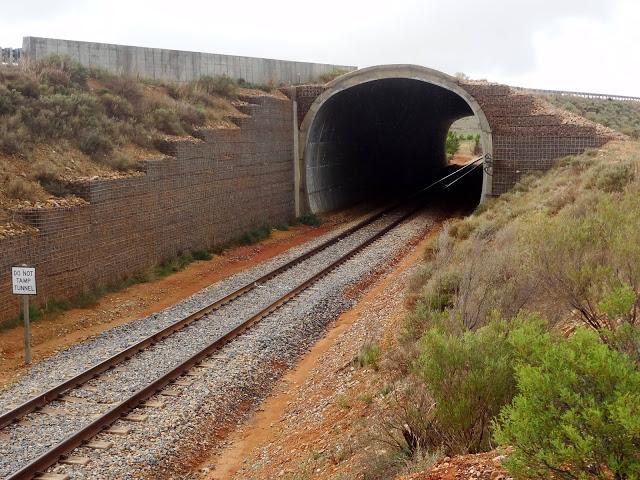
Sticking to railway themes....
cheers
YarnMaster
Hi,
Hint.
Similar area to previous bridge.
Cheers
 Posting Permissions
| Search AULRO.com ONLY! |
Search All the Web! |
|---|
|
|
|
Bookmarks