

 Reply With Quote
No Bushie, that one looks suspiciously like its near dingo airstrip, the one I'm referring to marks a junction near Taralinga Well. Still can't post to Photobucket !@#^%$#.
Deano

 AT REST
Do you mean like this ?
It's within 100km of this photo
Martyn
1998 Defender
2008 Madigan
2010 Cape York
2012 Beadell, Bombs and other Blasts
2014 Centreing the Simpson
VKS-737 mob 7669
ChatterBox
SubscriberNo Bushie, that one looks suspiciously like its near dingo airstrip
Deano
ChatterBox
SubscriberSomewhere up this track ?
Deano
AT REST
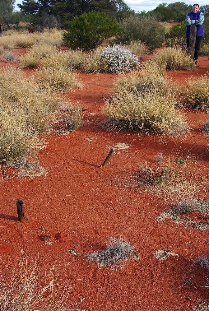
Don't recall that marker, but Tallaringa well and Dingo claypan - you are definitely in the right area.
It's not on the Anne Beadell though.
Martyn
1998 Defender
2008 Madigan
2010 Cape York
2012 Beadell, Bombs and other Blasts
2014 Centreing the Simpson
VKS-737 mob 7669
ChatterBox
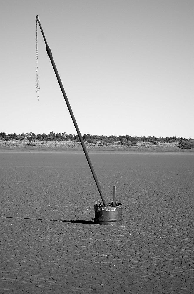
SubscriberThat marker is at the intersection of 'line of fire' and the Anne Beadell Hwy. I can't help having a bit of a chuckle when I use the term Hwy to describe this 'road'.
I haven't been up the centre line of fire 'track' but my guess will be the 250 mile post as I believe Len Beadell left markers at regular intervals along this route.
Deano
ChatterBox
SubscriberHow's the Anne Beadell Hwy these days Deano? It was our first major outback foray back in 2001 and Mabel Creek to Tallaringa still rates as the most corrugated track I have driven. Would love to be out there now.
I'd agree that marker must be on the 'centre line of fire' as I don't recall any of that type on the ABH.
AT REST
Originally Posted by DeanoH

Correct location 250mile post - finally found a pic with the other post in it, had to go through photos from the whole group to find it though.
Where to now ?
Original pegs holding down the canvas cross.
Martyn
1998 Defender
2008 Madigan
2010 Cape York
2012 Beadell, Bombs and other Blasts
2014 Centreing the Simpson
VKS-737 mob 7669
Wizard
SubscriberThere was no track. Just a couple of hundred miles of pinstriping mulga. Great trip and great company with the Edjits.
We occasionally saw what were very old "wheeltracks" but I think calling it a track would be as much of stretch as the Anne Beadell "Highway"
Chenz
I do not wish to be a member of any club that would have me as a member
Former Owner of The Red Terror - 1992 Defender 200Tdi
Edjitmobile - 2008 130 Defender
ChatterBox
SubscriberHi POD, we find the area 'around' the Anne Beadell Hwy very interesting. The desert landscape and fauna/flora is often unique to the area and generally unspoiled. The history and people of the area over many years whether it be the constructors of unusual rock formations or the current indigenous people or the background to the atomic bomb tests or the people involved all weaves it's own web. Not forgetting or undervaluing Len Beadells role in opening up this area and outback in general which IMO makes him Australia's 'Last Explorer' (with apologies to Hubert Wilkins).
Like you I reckon the Anne Beadell Hwy is the roughest road in the country, in particular the section between Emu and Tallaringa Well.
Corrugations like this through windy, washed out and rutted terrain make it a 'challenging' drive.
Here's the next location
This mountain was named by an explorer much admired by Len Beadell who affixed a plaque nearby in 1960.
Deano
AT REST
That I think would be Mt Leisler
(SW of Sandy Blight Junction)
Martyn
1998 Defender
2008 Madigan
2010 Cape York
2012 Beadell, Bombs and other Blasts
2014 Centreing the Simpson
VKS-737 mob 7669
 Posting Permissions
| Search AULRO.com ONLY! |
Search All the Web! |
|---|
|
|
|


Bookmarks