

 Reply With Quote
That coordinate is east of long reef. Maybe a good fishing mark.

 AT REST
On the way back from Nundle over the weekend I took the Nundle to Scone road (aka Hunter Road / MR105). Whilst it is a very picturesque drive it's definitely NOT suitable for anything other than a 4WD. or even a 4WD after heavy rain.
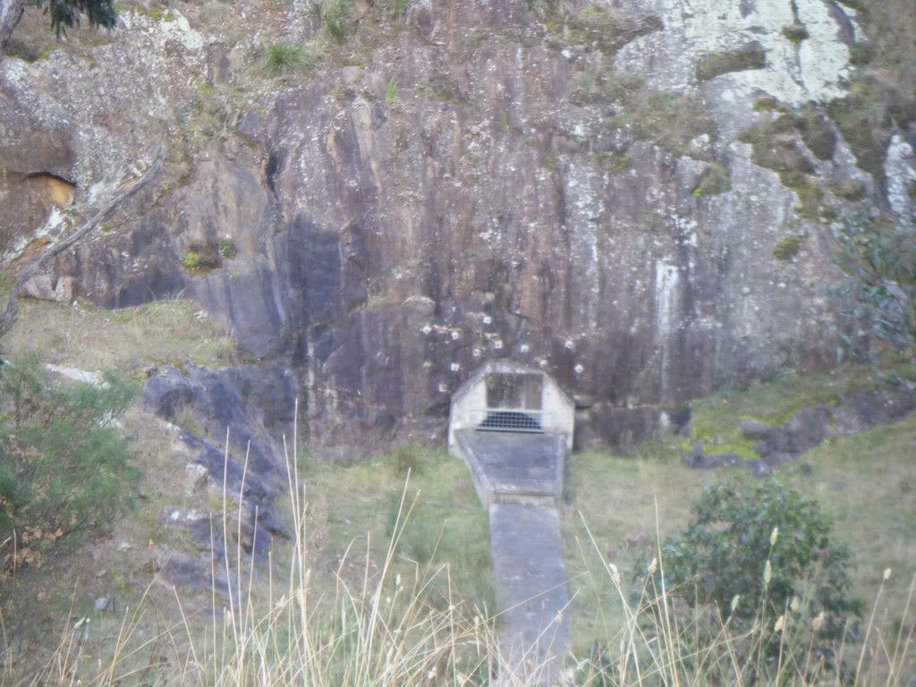
Anyway at 31 44 39.835S, 151 23 52.13E I came across this structure,
and just further downstream was a discharge headwall with warnings about high velocity water discharge etc. Given there are no significant dams around, I thought maybe some form of outlet for water pumped up from a mine? The pipe was around 1metre diam. It obviously used to discharge straight into the creek, but maybe erosion of the road (where I was stopped) became a problem.
Any ideas what it is for ??
Martyn
Last edited by Bushie; 28th May 2008 at 05:36 PM. Reason: Fixed typo with latitude ~ 31 not 33
1998 Defender
2008 Madigan
2010 Cape York
2012 Beadell, Bombs and other Blasts
2014 Centreing the Simpson
VKS-737 mob 7669
YarnMaster
That coordinate is east of long reef. Maybe a good fishing mark.
Master
Hi Martyn, I saw that structure some years ago and when I enquired about it from someone who lived up at Nundle, they thought it was to do with a scheme to pump water from one river into another ,presumably to maintain flow in the second river.Someone else will undoubtedly have more information in due course. Cheers, 130man.
AT REST
Hmmm typo all fixed nowOriginally Posted by Bush65

Martyn
1998 Defender
2008 Madigan
2010 Cape York
2012 Beadell, Bombs and other Blasts
2014 Centreing the Simpson
VKS-737 mob 7669
YarnMaster
There are a few of those in that area - all in dry creeks or the like. They have been built sometime in the last 10 years.
I can only guess their purpose, but remember Kerry Packer (he owned the property) had plenty of money for such things.
 Posting Permissions
| Search AULRO.com ONLY! |
Search All the Web! |
|---|
|
|
|

Bookmarks