


 Reply With Quote
Hmm maybe something else is going on then.Originally Posted by Saitch

Stationary in an open field even a "poor" GPS should be able to get a fix better than 100m

 OldBushie
Subscriber
OldBushie
Subscriber[quote=Tombie;2177180]Hema maps are on GDA94 so, if using an Hema app, I would want to be using the corresponding format. Just me being pernickety again.
Steve
Master
Hmm maybe something else is going on then.
Stationary in an open field even a "poor" GPS should be able to get a fix better than 100m
Last edited by FeatherWeightDriver; 4th July 2014 at 02:39 PM. Reason: Noob error: Datum has nothing to do with the GPS accuracy. Must engage brain in high range before typing next time...
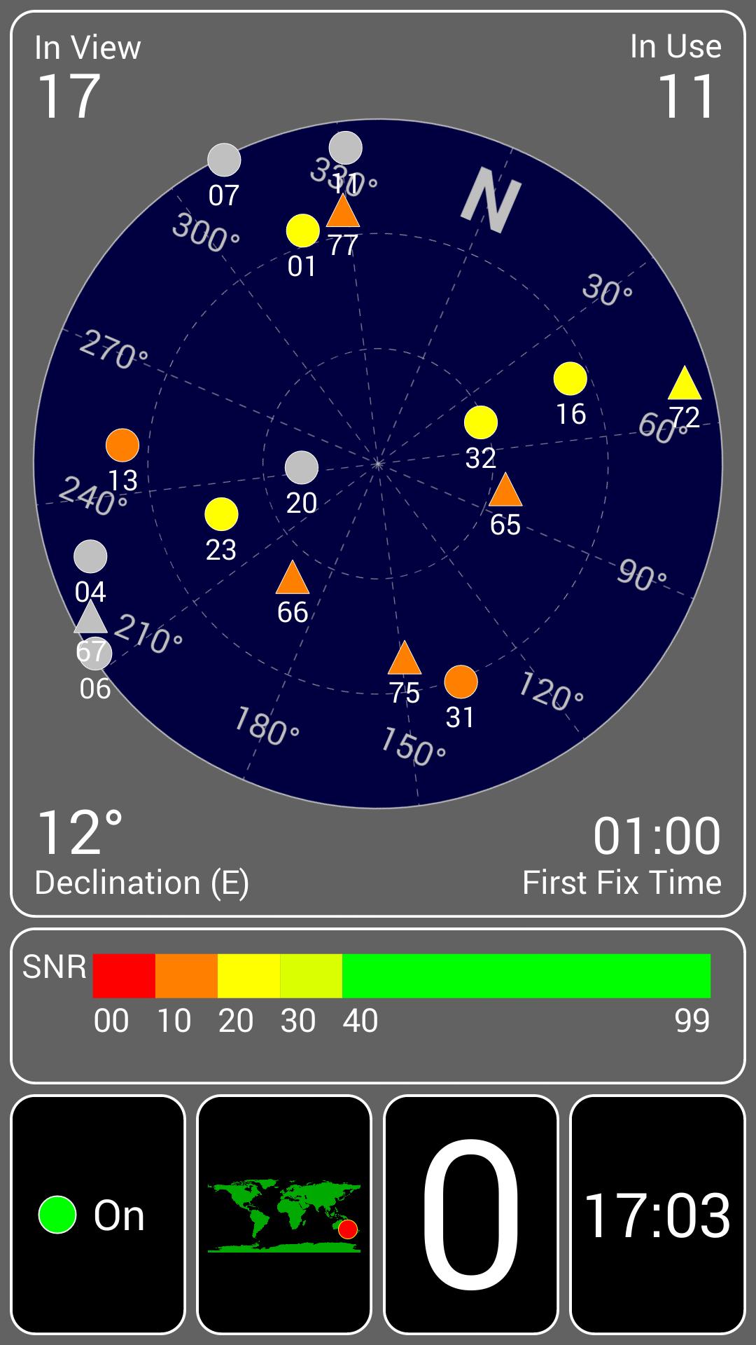
Most gps will give a DOP on the Satellite data page.
Looking at it will also let you see the relative position of the "birds".
What you want is a good feed from multiple birds sitting midway between the horizon and straight up (note you can not influence this).
Birds low to the horizon or directly overhead induce greater error in the triangulation.
RoverLord
I strongly suspect that for much of the published maps of Australia (whether digital or paper) and even after the speroid and datum are correct, the basic information is often not within 100m. And your identification of features, especially cadastral features, could easily have errors of this sort of order. For example, fences are not necessarily on property boundaries, and roads etc may have been realigned since the map was updated.
John
John
JDNSW
1986 110 County 3.9 diesel
1970 2a 109 2.25 petrol
Master
Agreed (and clarified in my earlier post).
2 possible issues:
- the accuracy of the GPS
- the accuracy of the maps
OldBushie
SubscriberAgreed & with a non dedicated GPS such as An IPad I don't know whether The positions are able to be viewed. Not on my Iphone anyway.
Steve
OldBushie
SubscriberJohn, I was pretty sure where I was as I'd located, by survey, 4 pegs & 4 recovery marks placed in the early 90's & even with a scale factor applied, the phone position would still be poor.
Steve
Master
I'm pretty sure IPhone's don't make detailed GPS data available. What you get is what you get.
Android devices, on the other hand, allow full access so you can see what satellites you are seeing, signal quality etc.
This is what I get sitting in my house... please don't tell anyone where I live
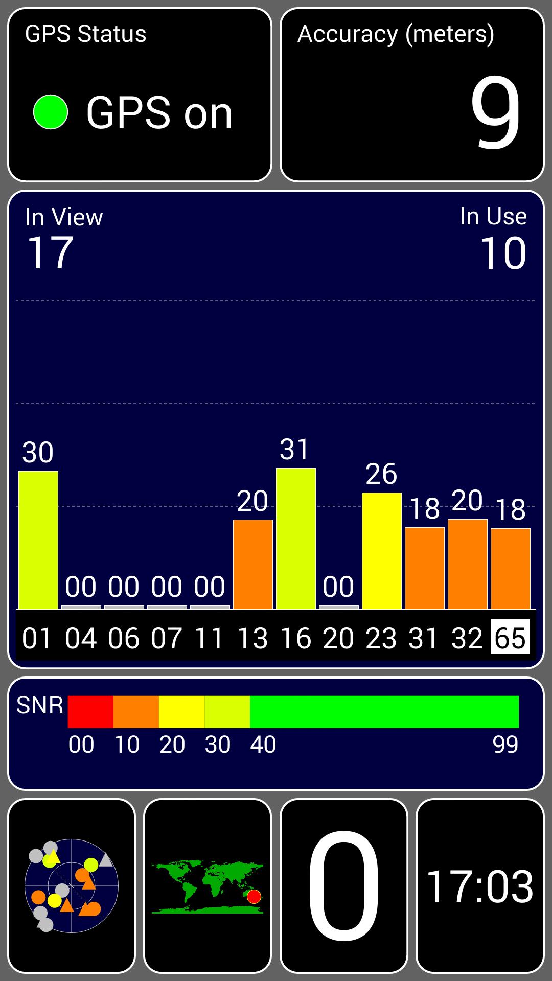
Last edited by FeatherWeightDriver; 4th July 2014 at 04:17 PM. Reason: Tried to make the image smaller, with no luck, sorry
No worries mate... Coffee, chat... Welcome to drop in...
Master
We regularly do geocaching with the iphone GPS and it always gets us within 5 metres or so.
 Posting Permissions
| Search AULRO.com ONLY! |
Search All the Web! |
|---|
|
|
|
")

Bookmarks