Page 2 of 2 FirstFirst 12
Results 11 to 17 of 17

Thread: bendethra

  1. #11
    Join Date
    Jan 1970
    Location
    Moruya Heads/Sth. Coast, NSW
    Posts
    6,532
    Total Downloaded
    0
    Quote Originally Posted by Bushie View Post
    If you come in from Moruya that will be as you cross the second time, coming from ther Braidwood side turn left at the bottom and it will be after your first crossing.

    The best advice would be to get there with a few hours of light left and have a good look around before you set up there are some excellent spots.

    Have a look on google earth at 35 58 02S, 149 44 24E, that is about the spot Frank mentioned, but theres plenty more.


    Martyn
    Bushie, it certainly is a top spot when there are none or only a few people there, gets busy on weekends and holidays, the other spot I like at Bendethra is at 35 56'52.83 S 149 44'51.32 E on Google Earth, plenty of shade under big She Oaks river deep enough to swim in and a creek joins the river on your right, a really idillyic spot. I found a great spot with some challenging driving directly north of Bendethra on the Mongamulla Fire trail, it runs off the Mericumbene fire trail and down into some nice valleys and good swimming holes. I'm very lucky to have so many good 4WD tracks to explore so close to home, have you had a look at the Hanging Mountain lookout on Little Sugarloaf road, it's before you get to the intersection of Little Sugarloaf, Bendethra and Mericumbene tracks, worth a look, Regards Frank.

  2. #12
    Join Date
    Jan 1970
    Location
    Moruya Heads/Sth. Coast, NSW
    Posts
    6,532
    Total Downloaded
    0
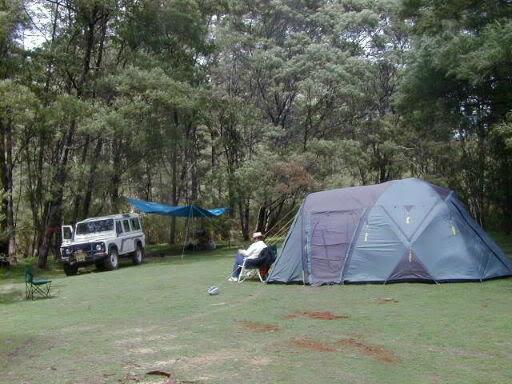
    Martyn, if your interested the junction of Mongamulla fire trail and Mericumbene Fire trail , Google earth co-ords are 35 52'14.26 S 149 49'27.19 E and a nice spot to start exploring is 35 51'08.55 S
    149 45'49.13 E, pretty steep drive down to the river and would not be accessible when wet, Regards Frank.

  3. #13
    Join Date
    Jan 1970
    Location
    Douglas Park, NSW
    Posts
    9,347
    Total Downloaded
    0
    Quote Originally Posted by Tank View Post
    a nice spot to start exploring is 35 51'08.55 S
    149 45'49.13 E, pretty steep drive down to the river and would not be accessible when wet,
    That's a great spot there. It's a pity it's private property & camping isn't allowed (according to the sign anyway).
    Scott

  4. #14
    Join Date
    Jan 1970
    Location
    Moruya Heads/Sth. Coast, NSW
    Posts
    6,532
    Total Downloaded
    0
    Quote Originally Posted by Scouse View Post
    That's a great spot there. It's a pity it's private property & camping isn't allowed (according to the sign anyway).
    Scott, never camped there just had a swim and lunch, travelled further on to unlocked gate and off property and camped there, according to State Forests map it is (where I camped) State Forest, Regards Frank.

  5. #15
    Join Date
    May 2002
    Location
    Heathcote (in "The Shire")
    Posts
    5,348
    Total Downloaded
    0
    Have to agree it's a superb area to explore, the coords you gave are down towards 'Alpine' are you allowed to camp down there? - a bit unsure where the NP ends and the private farm starts.

    Google tracks

    Different ways around and into Bendethra


    Merricumbene Trail

    Martyn

  6. #16
    Join Date
    Jan 1970
    Location
    Moruya Heads/Sth. Coast, NSW
    Posts
    6,532
    Total Downloaded
    0
    Quote Originally Posted by Bushie View Post
    Have to agree it's a superb area to explore, the coords you gave are down towards 'Alpine' are you allowed to camp down there? - a bit unsure where the NP ends and the private farm starts.

    Google tracks

    Different ways around and into Bendethra


    Merricumbene Trail

    Martyn
    I have some pics of the same spot, did you notice how the dead trees border the FT for miles, it is an eerie place to be when the weather closes in the clouds seem to sit about 20 feet above the track and with the trees along side it looks like a bizarre tunnel, love it, Regards Frank.

  7. #17
    Join Date
    Jan 1970
    Location
    Moruya Heads/Sth. Coast, NSW
    Posts
    6,532
    Total Downloaded
    0
    Quote Originally Posted by Bushie View Post
    Have to agree it's a superb area to explore, the coords you gave are down towards 'Alpine' are you allowed to camp down there? - a bit unsure where the NP ends and the private farm starts.

    Google tracks

    Different ways around and into Bendethra


    Merricumbene Trail

    Martyn
    Martyn, if you get the South Coast Forest map from the State Forests office it shows the area I camped as State Forest Native, Regards Frank.

Page 2 of 2 FirstFirst 12

Bookmarks

Bookmarks

Posting Permissions

  • You may not post new threads
  • You may not post replies
  • You may not post attachments
  • You may not edit your posts
  •  
Search AULRO.com ONLY!
Search All the Web!